regional Royalty Free Vector Images (1,238)
Page 8 of 25

Aircrafts concept line style vector icons set.
VectorUsername
ConceptCafeResolution
6000x3375pxAircrafts concept line style vector icons set.


Aircrafts concept line style vector icons set.
VectorUsername
ConceptCafeResolution
6000x3375pxAircrafts concept line style vector icons set.

Flag of Hesse single element hand drawn isolated on white background
VectorUsername
vas_evgResolution
2000x2000pxFlag of Hesse single element hand drawn isolated on white background

Two crossed flags of Hesse hand drawn illustration
VectorUsername
vas_evgResolution
3000x2000pxTwo crossed flags of Hesse hand drawn illustration

Flag of Hesse waving in the wind vector sketch.
VectorUsername
vas_evgResolution
2000x2000pxFlag of Hesse waving in the wind vector sketch.


Aircrafts concept line style vector icons set.
VectorUsername
ConceptCafeResolution
5000x2812pxAircrafts concept line style vector icons set.


Aircrafts concept line style vector icons set.
VectorUsername
ConceptCafeResolution
5000x2812pxAircrafts concept line style vector icons set.


Liberia - solid black silhouette map of country area. Simple flat vector illustration
VectorUsername
pytyResolution
5000x5000pxLiberia - solid black silhouette map of country area. Simple flat vector illustration


Finland - solid black silhouette map of country area. Simple flat vector illustration
VectorUsername
pytyResolution
5000x5000pxFinland - solid black silhouette map of country area. Simple flat vector illustration


Administrative counties of Romania. Simple flat vector map
VectorUsername
pytyResolution
5000x3526pxAdministrative counties of Romania. Simple flat vector map


Administrative counties of Romania. Vector map in four shades of green
VectorUsername
pytyResolution
5000x3526pxAdministrative counties of Romania. Vector map in four shades of green


India blue marked in political map of South Asia and Middle East. Simple flat vector map
VectorUsername
pytyResolution
5000x3333pxIndia blue marked in political map of South Asia and Middle East. Simple flat vector map

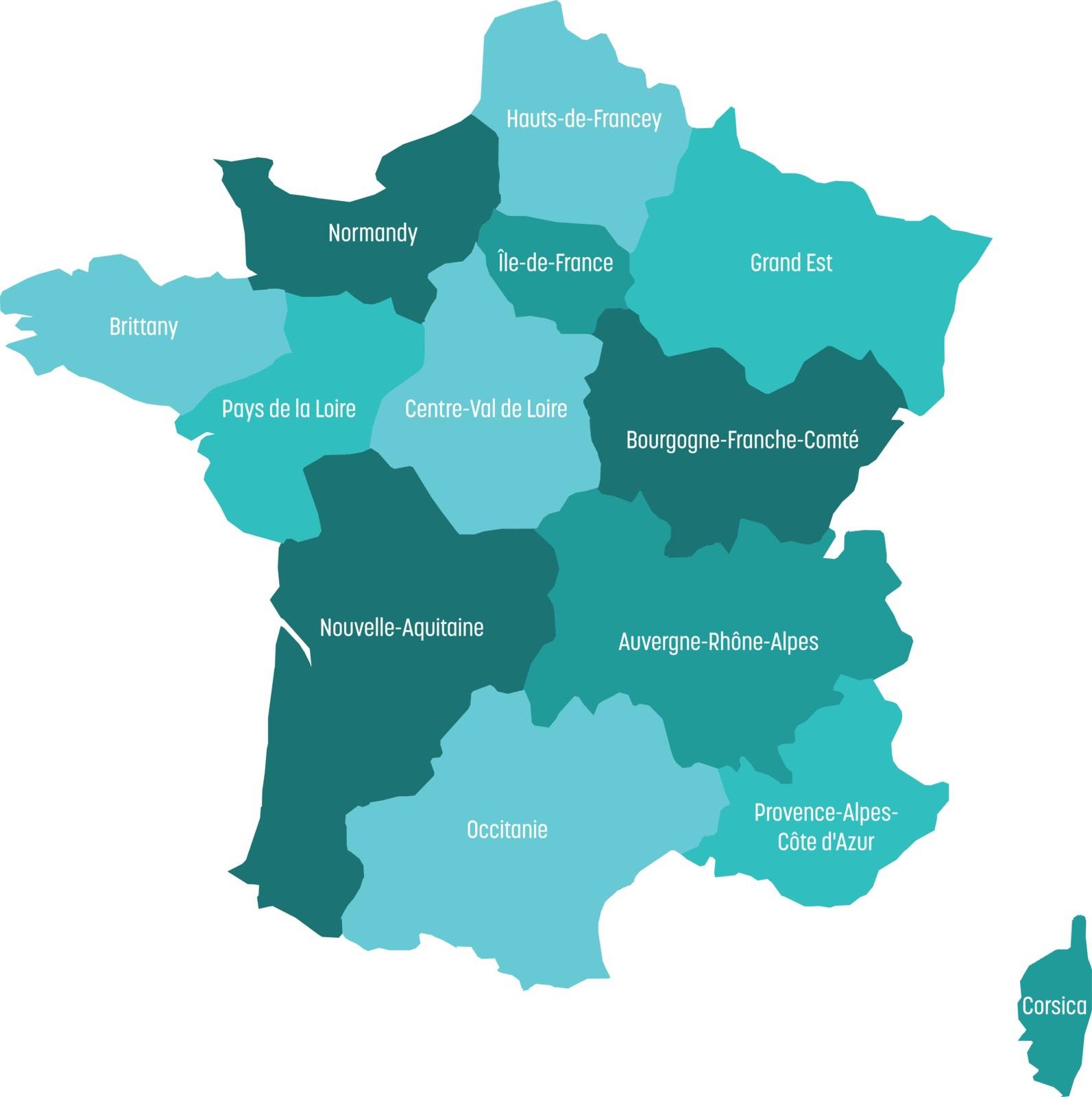
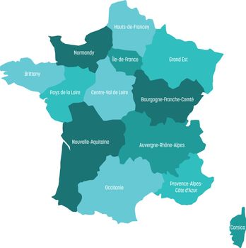
Map of France divided into 13 administrative metropolitan regions, since 2016. Four shades of green. Vector illustration
VectorUsername
pytyResolution
4977x5000pxMap of France divided into 13 administrative metropolitan regions, since 2016. Four shades of green. Vector illustration

Map of France divided into 13 administrative metropolitan regions, since 2016. Warm colors. Vector illustration
VectorUsername
pytyResolution
4977x5000pxMap of France divided into 13 administrative metropolitan regions, since 2016. Warm colors. Vector illustration


Map of France divided into 13 administrative metropolitan regions, since 2016. Four shades of green. Vector illustration
VectorUsername
pytyResolution
4977x5000pxMap of France divided into 13 administrative metropolitan regions, since 2016. Four shades of green. Vector illustration


Grey map of France divided into 13 administrative metropolitan regions, since 2016. Vector illustration
VectorUsername
pytyResolution
4976x5000pxGrey map of France divided into 13 administrative metropolitan regions, since 2016. Vector illustration


Map of Italy, Verbano-Cusio-Ossola
VectorUsername
Istanbul2009Resolution
4285x5000pxMap of Italy, Verbano-Cusio-Ossola


Map of Italy, Barletta-Andria-Trani
VectorUsername
Istanbul2009Resolution
4285x5000pxMap of Italy, Barletta-Andria-Trani


Map of Serbia, Autonomous Province of Vojvodina
VectorUsername
Istanbul2009Resolution
3464x5000pxMap of Serbia, Autonomous Province of Vojvodina


Map of Serbia, Subdivision City of Belgrade
VectorUsername
Istanbul2009Resolution
3424x5000pxMap of Serbia, Subdivision City of Belgrade


Venezuela map with official flag
VectorUsername
domencoljaResolution
5000x5000pxVenezuela map with official flag


Peru map with official flag
VectorUsername
domencoljaResolution
5000x5000pxPeru map with official flag


Colombia map with official flag
VectorUsername
domencoljaResolution
5000x5000pxColombia map with official flag


Chile map with official flag
VectorUsername
domencoljaResolution
2123x5000pxChile map with official flag


Brazil map with official flag
VectorUsername
domencoljaResolution
5000x5000pxBrazil map with official flag


Argentina map with official flag
VectorUsername
domencoljaResolution
5000x5000pxArgentina map with official flag


country,mumbai,county,simple,graphics,division,trip,province,geography,state,border,area,new,image,making,provinces,shape,cartography,easy,creative,district,silhouette,region,geographical,city,regional,isolated,districts,india,modern,composition,flat,design,federal,vector,department,map,designed,graphic,federation,black,alternative,2016,2015,administrative,goa,illustration,delhi,territory
VectorUsername
ogqcorpResolution
851x851pxcountry,mumbai,county,simple,graphics,division,trip,province,geography,state,border,area,new,image,making,provinces,shape,cartography,easy,creative,district,silhouette,region,geographical,city,regional,isolated,districts,india,modern,composition,flat,design,federal,vector,department,map,designed,graphic,federation,black,alternative,2016,2015,administrative,goa,illustration,delhi,territory


continent,country,scheme,city,regional,isolated,county,political,simple,division,world,stylized,trip,white,modern,flat,geography,design,jordan,national,governorates,colored,vector,power,state,department,plan,map,europe,graphic,border,area,new,provinces,shape,amman,black,contour,mainland,2015,background,administrative,district,silhouette,illustration,region,territory,eps8
VectorUsername
ogqcorpResolution
1855x851pxcontinent,country,scheme,city,regional,isolated,county,political,simple,division,world,stylized,trip,white,modern,flat,geography,design,jordan,national,governorates,colored,vector,power,state,department,plan,map,europe,graphic,border,area,new,provinces,shape,amman,black,contour,mainland,2015,background,administrative,district,silhouette,illustration,region,territory,eps8


continent,country,scheme,city,regional,isolated,county,political,simple,division,world,stylized,trip,white,modern,flat,geography,design,jordan,national,governorates,colored,vector,power,state,department,plan,map,europe,graphic,border,area,new,provinces,shape,amman,black,contour,mainland,2015,background,administrative,district,silhouette,illustration,region,territory,eps8
VectorUsername
ogqcorpResolution
1853x851pxcontinent,country,scheme,city,regional,isolated,county,political,simple,division,world,stylized,trip,white,modern,flat,geography,design,jordan,national,governorates,colored,vector,power,state,department,plan,map,europe,graphic,border,area,new,provinces,shape,amman,black,contour,mainland,2015,background,administrative,district,silhouette,illustration,region,territory,eps8


Tibet waving flag. Tibet national flag background texture.
VectorUsername
boldgResolution
8100x5068pxTibet waving flag. Tibet national flag background texture.


Taiwan Map, states border map. Vector illustration.
VectorUsername
VertybResolution
4584x4167pxTaiwan Map, states border map. Vector illustration.

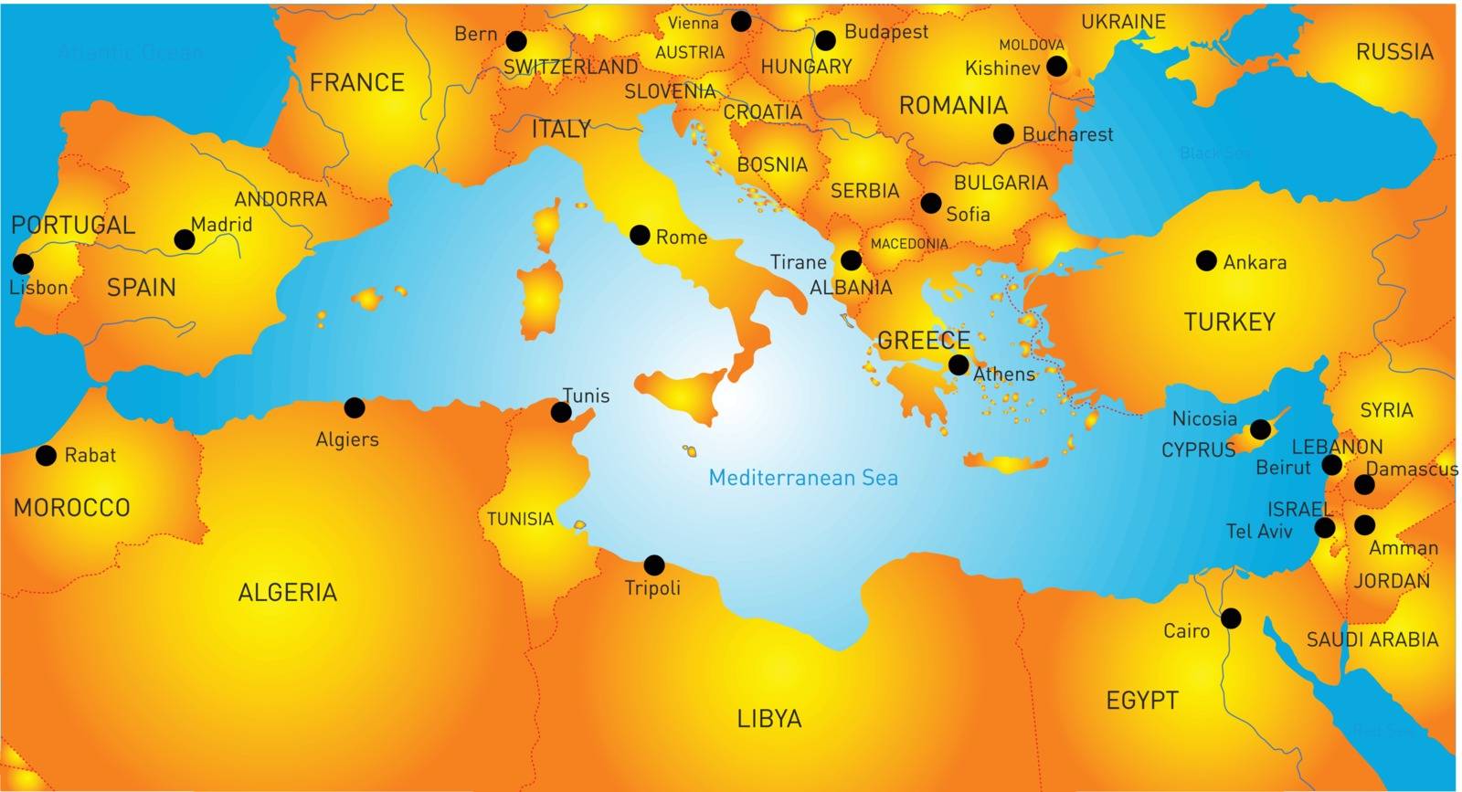
Mediterranean region
VectorUsername
rusakResolution
5000x2708pxMediterranean region


Election day concept. Hand drawn isolated vector.
VectorUsername
VasilyevaResolution
7500x5000pxElection day concept. Hand drawn isolated vector.


Election day concept. Hand drawn isolated vector.
VectorUsername
VasilyevaResolution
7500x5000pxElection day concept. Hand drawn isolated vector.


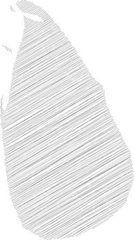
Sri Lanka - solid black silhouette map of country area. Simple flat vector illustration
VectorUsername
pytyResolution
2792x5000pxSri Lanka - solid black silhouette map of country area. Simple flat vector illustration
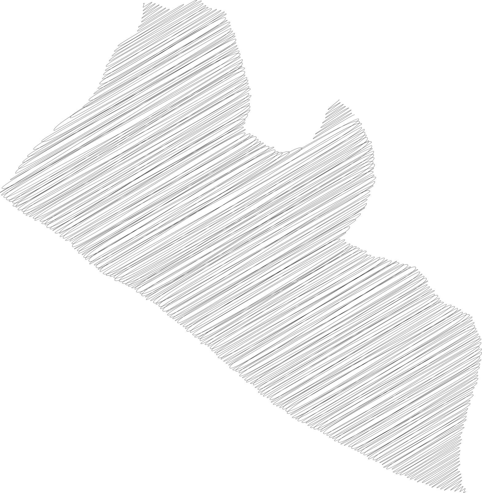
Liberia - pencil scribble sketch silhouette map of country area with dropped shadow. Simple flat vector illustration
VectorUsername
pytyResolution
4892x5000pxLiberia - pencil scribble sketch silhouette map of country area with dropped shadow. Simple flat vector illustration


Finland - pencil scribble sketch silhouette map of country area with dropped shadow. Simple flat vector illustration
VectorUsername
pytyResolution
3438x5000pxFinland - pencil scribble sketch silhouette map of country area with dropped shadow. Simple flat vector illustration


Political map of Balkans - States of Balkan Peninsula. Simple flat black outline with black country name labels
VectorUsername
pytyResolution
5000x5000pxPolitical map of Balkans - States of Balkan Peninsula. Simple flat black outline with black country name labels


Political map of Balkans - States of Balkan Peninsula. Four shades of orange vector illustration
VectorUsername
pytyResolution
5000x5000pxPolitical map of Balkans - States of Balkan Peninsula. Four shades of orange vector illustration


Political map of Balkans - States of Balkan Peninsula. Four shades of turquoise blue vector illustration
VectorUsername
pytyResolution
5000x5000pxPolitical map of Balkans - States of Balkan Peninsula. Four shades of turquoise blue vector illustration


Political map of Balkans - States of Balkan Peninsula. Four shades of pink vector illustration
VectorUsername
pytyResolution
5000x5000pxPolitical map of Balkans - States of Balkan Peninsula. Four shades of pink vector illustration


Political map of Balkans - States of Balkan Peninsula. Four shades of grey vector illustration
VectorUsername
pytyResolution
5000x5000pxPolitical map of Balkans - States of Balkan Peninsula. Four shades of grey vector illustration


Political map of Balkans - States of Balkan Peninsula. Four shades of green vector illustration
VectorUsername
pytyResolution
5000x5000pxPolitical map of Balkans - States of Balkan Peninsula. Four shades of green vector illustration


Administrative counties of Romania. Vector map with labels
VectorUsername
pytyResolution
5000x3527pxAdministrative counties of Romania. Vector map with labels


Administrative counties of Romania. Vector map in four shades of orange
VectorUsername
pytyResolution
5000x3526pxAdministrative counties of Romania. Vector map in four shades of orange


Administrative counties of Romania. Vector map in four shades of turquoise blue
VectorUsername
pytyResolution
5000x3526pxAdministrative counties of Romania. Vector map in four shades of turquoise blue


Administrative counties of Romania. Vector map of thin black outline on white background
VectorUsername
pytyResolution
5000x3527pxAdministrative counties of Romania. Vector map of thin black outline on white background


Administrative counties of Romania. Vector map of thin black outline on white background
VectorUsername
pytyResolution
5000x3527pxAdministrative counties of Romania. Vector map of thin black outline on white background


Administrative counties of Romania. Vector map with labels
VectorUsername
pytyResolution
5000x3527pxAdministrative counties of Romania. Vector map with labels
